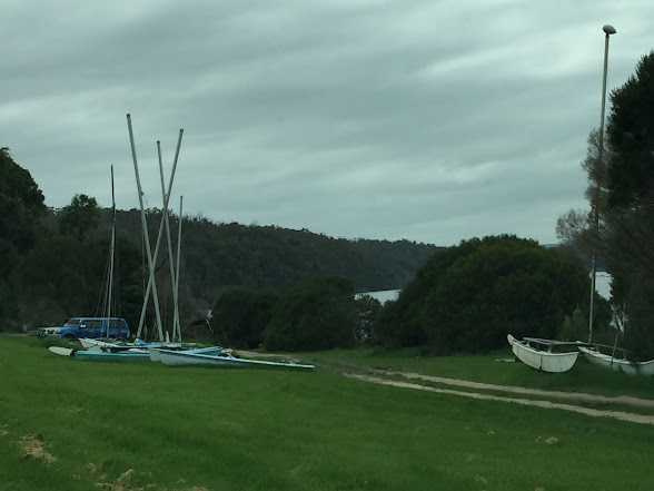
Every time we travel south along the coast and stay at Genoa Rest Area, we only a stay a night - for various reasons - but this time we decided to stay the 72 hours allowed, and head to Mallacoota. The Coastline of the Croajingolong National Park is classed as a true wilderness coastline, and the Croajingolong National Park surrounds Mallacoota. Located on the Genoa and Wallagaraugh Rivers, with approximately 320 km of coastline around beautiful lakes, rocky coastline and secret beaches, it is certainly beautiful.
Post 2019/20 horrific bush fires, the trees are looking both eerie and magical on the way to Mallacoota.
First impressions were Mallacoota is one large caravan park. It is actually about four or five caravan parks. There are a number of cafes -all seem to close at or before 2pm. There are two supermarkets - Foodworks and IGA, a pub and a few service establishments. But the coast is absolutely beautiful.
Home to the Bidwal people, first Europeans came in the 1830's when whalers Ben Boy and the Imlay Brothers established Mallacoota Inlet as their major whaling station south of Two Fold Bay.
One of the first pastoralists was Captain John Stevenson, a whaler who was given a grazing licence in 1841, and he set up his residence at what is now known as Captain Stevenson's Point.
Nearby is a memorial dedicated to poet and friend of Henry Lawson, Edwin James Brady. He established a writers camp at Captain Stevenson's Point in 1909.
The first town in the area was Lakeview, on the eastern section of the river. The first dwelling was built in 1882 by John Augustus Dorron. He built a home and a hotel from the local timbers, and the hotel became popular with tourists, particularly during the gold rush of the 1890's. The only way into the town was by sea until the 1890's when people would horse ride from Gipsy Point, the closest main trading centre. The hotel became the social centre of the area, and included a post office. Lakeview had a small gold rush in the 1890's with over 50 claims established, but only one - The Spotted Dog Mine - was successful. There is a pioneer cemetery where the old town use to be, and also an old gold mine.A site for a town was reserved at the western entrance of the bay in 1897, and in 1909 a national park was set aside. It wasn't until 1918 that a township was surveyed, I assume on land from Captain Stevenson's lease. Hotels and guesthouses were established by the 1920's and tourists continued to come to the area. Originally known as West Mallacoota, Mallacoota is a Krauaetunglung Aboriginal word meaning 'the place of many waters' as the lake and the ocean provided plentiful food. In 1921 a road was built from Gipsy Point to Mallacoota and more shops and businesses were developed.
The airport was built in the 1940's by the Royal Australian Air Force. We visited an old WW2 bunker located next to the airfield.
There were two bunkers established during the war as part of a chain of bases were used for surveillance of the south eastern waters and Bass Strait. One of the bunkers has been restored by the local RSL and historical society.
It is only open Tuesday and Sunday mornings. There are information boards around the bunker that tell of the history of not only the bunker, but also Mallacoota.We had a look at many beaches along the coast south of Mallacoota and had a picnic lunch at Quarry Beach.One first notices the wavy rock layers cut into the hill at the car park, like ribbons of colour, believed to be formed about 500 millions years ago.


No comments:
Post a Comment