Travelling from Timber Creek, about 228km, to Kununurra, our first stop was at the Bulldust to Beef Roads monument, to commemorate the importance of the finalisation of sealing the Victoria Highway. Originally positioned to reflect the noon sun on the plaque, sadly the plaque had been removed.
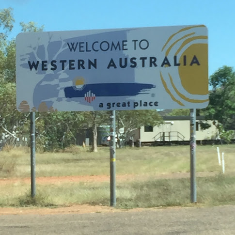
The next stop was at the border. Normally the border checks for only food and plant quarantine, but in these weird times the check was also for our border crossing eligibility pass. It didn't take too long, maybe 10 minutes at most.
Kununurra is located 40 km from the Northern Territory border along the Victoria Highway, and is situated on Lake Kununurra. It is known as the gateway to the beautiful Kimberley's. Kununurra means 'big water' in the local indigenous language, and although the town was only founded in the 1960's to accommodate workers on the Ord River dam project, Aboriginal peoples have lived in the area for thousands of years. Interestingly, Baz Luhrmann used the town as a base for cast and crew while filming his movie Australia, set at Carlton Hill, 50 minutes drive from Kununurra.
We stayed at the Town Caravan Park, which was secure and managed by a lovely couple. The sites were cramped and there were some permanents. The pool was way too small for the size of the caravan park, but it was walking distance from the town. At $40 per couple plus $10 per child it was expensive, but also the cheapest in Kununurra. It has a high fence around it and a security gate, so it is very secure.
We didn't have any trouble walking to town or walking around town, although we didn't walk around at night, and the town was quiet both day and night. The information centre is not on the main road, but on a ring road one block from town shops, and has a lot of brochures etc. The staff themselves are very busy with booking tours etc, as we have found in a few info centres this trip.
We were fortunate to go into a most unique store that runs off the info centre and we met the owner Penney. A lovely lady that answered all our questions about the area and we amazed at the lovely products she has, most from her amazing photography. Please check out her website Kimberley Photography - amazing.
Lake Kununurra was formed as part of the Ord River damming, as was Lake Argyle. It was absolutely beautiful both day and night.
Plenty to see in and around Kununurra. A highlight for Peter was the Ivanhoe Crossing, originally the main road from Kununurra to Wyndham. Built of concrete across the Ord River, it flows all year and in the wet season is not cross-able. There is ample signage and gates to close the road if the water is too high.
The current is very strong and the river has crocodiles..... and barramundi. Swimming is not allowed but we saw locals swimming.
The old pumping station on the banks of Lake Kununurra was once very important to the Ord River Irrigation Scheme. The town was being established and supported the local agricultural industry, so a good source for the water supply was important. After the damming of Lake Argyle the pump house was no longer needed and it was decommissioned in 1971, although the pumping station was left as an emergency backup. The pump house was not fully decommissioned until 2004 and in 2007 it was included in the register of the Heritage of Western Australia. The same year the lease was taken over by two locals and they developed the site into restaurant. In 2008 the Pumphouse Restaurant was opened for business.
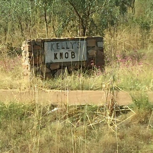
Another place to visit is Kelly's Knob, located off Kelly's Road, a short drive to the top and a 30m walk over rocky steps for a great view of Kununurra.
Mirima National Park ($15 entry per car), also known as Hidden Valley, is a small and scenic 350 million year old sandstone range, only 2km from the shops, and a short drive in to a small picnic area surrounded by boab trees. There are many walks from the picnic area with interpretative signage. For a small NP, the landscapes were spectacular, and changed with the colours. Mirima is the name given by the local
Miriwoong Aboriginal people, and means walking trail. We were told it was like a mini Bungle Bungles and the colours were beautiful. Some of the walks were short and others long.
This was our
first National Park using our National Park pass. We didn't think the pass was worth it for us. We paid $75 concession for an annual pass plus $10 booking fee. A month pass was not worth it for us as we knew we would be in Western Australia for at least 3-4 months.
We did a day trip to Lake Argyle and had a picnic lunch at the dam wall. A drive of about an hour back towards the NT border, an interesting drive along the old access road. We stopped to explore some Indigenous cave paintings, not far from the road - thank you Wiki Camps.
Just before the Lake Argyle Caravan Park and Resort is the old Durack Homestead. The
Duracks were the first Europeans settlers in the East Kimberleys.
Patrick and his family of of six children travelled across Queensland
and Northern Territory, taking over two years and traveling 4828kms,
they built a homestead in the 1890's in the now flooded Lake Argyle. The
homestead was relocated after the Argyle dam was created in 1970's.
Every stone was numbered and the homestead was rebuilt and opened to the
public in 1979. The Duracks were the first Europeans in the Ord valley
to establish a station that led to the opening up of North-Western
Australia. The history of the Durack family from Ireland is very
interesting and worth reading. The homestead is now a museum with
artifacts and displays at Lake Argyle. Cost is $5 per adult.
Lake Argyle is Western Australia's largest freshwater lake at about 1000sq.km and Australia's second largest - the largest being Lake Macleod at approximately 1500sq.km. The Commonwealth Government provided a grant for the construction of the Ord River Dam in the Carr Boyd Ranges in 1967. This was to provide water storage for surrounding farms and properties. The remnants of the construction village have today become the Lake Argyle Resort and caravan park.
The first inhabitants to the area were the Miriuwung Gajerrong people. The first Europeans started to explore the area in 1879 and Alexander Forrest's reports of vast fertile lands led to many settlers, including the Duracks, who established the large cattle stations. The damming of the Ord River was first suggested in 1939 by Kimberley Durack, but no work was started until 1959.
We looked at many different tours from Kununurra. The area is large, too large to explore by a car towing a caravan. We decided the best way to see Lake Argyle and the Bungles Bungles was by Air. There are a few companies that provide tours, we chose Kimberley Air Tours, which we felt was great value for money. We were picked up at the van park by the pilot, Leigh, who is also the owner of the company. At the sea plane departure area, we were given a safety talk and boarded the small plane. Peter got to sit in the front seat next to the pilot, Leigh.
The flight was almost 4 hours and included a flight over Lake Argyle, the Bungle Bungles, the Argyle Diamond mine, and back to land on Lake Argyle to have afternoon tea and a swim on and island. The cost was high for us, at almost $500 each, but so worth it. Now we are home, it was certainly the highlight of our trip. The flight started on Lake Kununurra and flew over farms.
and along one side of Lake Argyle.
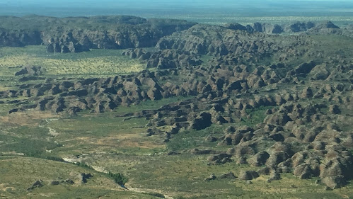
Located about 300km from Kununurra, Purnululu National Park, is the home of Cathedral Gorge
and the beautiful Bungle Bungles. The land forms were well known by the
Aboriginal people and were discovered by Europeans when a film crew in
1983 captured footage when filming a documentary in the north west of
the state.
Believed to be over 350 million years old during the Devonian age, and rising up to 300m, the park contains gorges and water holes and Aboriginal art. With two campsites that are unsuitable for caravans, and the expense of even storing our van and tent camping in the Purnululu National Park for one night, we decided the best way to see the park was this flight. We are not hikers, and there are many walks to see the attractions. The colours are formed by the different rock layers, the orange being oxidised iron compounds and the lighter greyish bands are cyanobacteria.We
were told the colours change during the day and in different seasons.
Very hot up in the north-west now (May), so I'm sure we would not like
the summers here.
Heading back towards Lake Argyle, we flew over Argyle Diamond mine, was the source of 90% of the world's pink diamonds, until it closed in 2020. Discovered in 1979 by the Ashton Joint Venture and the discovery of alluvial diamonds, it was established in 1983. It was the first major diamond mining operation in Australia, and became one of the top producers of the worlds diamond, especially the fames pink diamonds.
Next, back to Lake Argyle, named after Argle Downs, the name of the Durack family property. Lake
Argyle is the
largest man made lake in the southern hemisphere and can fill Sydney
Harbour 18 times over. There are about a hundred small rocky outcrops and islands in the lake, with over 70 islands an larger outcrops named. The island we landed on was Mary Durack, named after one of the Durack daughters.
The tea was perfect and the cakes, a choice of two were so delicious and came from a local Kununurra bakery.
Some people went swimming, but with about 30,000 fresh water crocodiles, I wasn't going in past my ankles.... and we did see one.
It was hot, as is the whole of the northern Australia, and no seating, so maybe we spent a little too long on the island, but it was, and still is (October 2021) the highlight of our whole trip (...and we saw some spectacular sights).


Such a great trip, I do so enjoy tagging along and marveling at the splendid Aussie scenery, so different from ours here in New Zealand. The plane trip must have been amazing, a lot of money but such a fabulous way to see the sights. And topped off with tea and cakes!
ReplyDeleteAs for the Ivanhoe Crossing, I had seen a video of it recently as Robin is a follower of a vlog of an Aussie family and their travels. I couldnt believe it when they towed their caravan across, that would take nerves of steel and a lot of skill I expect