We chose to base ourselves in Adelaide River and did a one day trip to Litchfield via Batchelor, 40 minutes each way. Our first stop was Batchelor, steeped in history. Goyder's survey party passed through the area in 1869 and in 1874 the roadhouse, Rum Jungle was constructed to supply travellers with a meal and drink on their travels.
The surrounding area was part of a farm owned by Mr. E.L. Batchelor. A section of the farm was set aside for the town with the arrival of servicemen during WWII. By 1949 and with the discovery of uranium, Australia's first uranium mine, the town began to flourish. There are information boards explaining the WWII history.
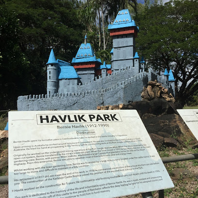
The information centre is tiny, but has enough info on the town. A walk around the town is interesting with many information boards with the history of the buildings. On the way out we came across a park with a model of a castle - above. This model was built by Bernie Havlik during his retirement. He was annoyed by the large rocky granite outcrop, so he built a miniature replica of Karlstejn Castle from his birthplace, Czechoslovakia. It took him 5 years to construct. It was Bernie who established most of the towns pine trees and mango trees.
There is a caravan park just outside Litchfield and we saw this unusual planter out the front. There are also camp grounds within the park.
Litchfield National Park covers about 1500 sq km and has been formed by water over thousands of years. The park is named after Frederick Henry Litchfield who was a member of the Finniss Expedition. The area was once a tin and copper mining area, and became a national park in 1986, and was opened in July 1991. There is a sealed road that runs through the park and all the attractions can be found off this road, many also on sealed roads.
We passed a number of termite hills on the way into Litchfield and stopped at the large Cathedral Mound.
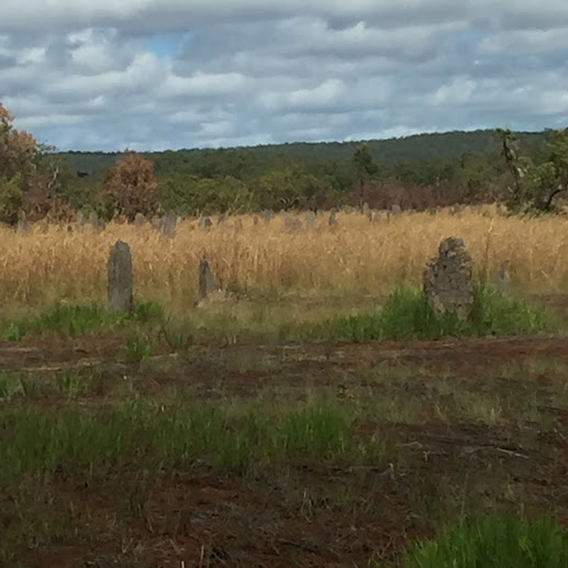
The other side of the parking area are the magnetic ant hills. Photos don't show the configuration very well. They are built in a way to allow the least amount of surface area to be exposed to the heat from the sun. Very clever. Looked very much like headstones.
We also visited a few different water holes and went swimming in Buley Waterhole.
A little way down a rocky path, to the waterholes was worth the walk. The steps were very slippery and there were quite a few people there.
Next stop was Florence Falls. There is a walk from Buley Water hole to Florence falls, but we drove. We walked down to the lookout to see the falls and Jonnie wanted to go to the bottom, so I went back to car to do my crosswords and Peter and Jonnie went down the 135 steps to the base of the falls.
Next stop was Tolmer Falls, named after Frederick Litchfield's late fathers friend, Alexander Tolmer.
It's a 500m walk to the lookout. There is no access to the gorge as there are protected species in the gully.
The one I was looking forward to, Wangi Falls was closed due to a croc sighting.
Also closed was the cafe, where we had planned to have lunch - lucky we had fruit and carrot sticks to eat. Wangi Falls are the largest falls and the most popular, probably because they are next to the camping grounds. We still had a walk down to the falls - spectacular. We also had a walk around the camp ground. Looked pretty good and only a short walk from the falls.
Historic Blyth Homestead, off Sandy Creek Road, was built in 1929 by the Sergeant Family. It was abandoned in the 1960's and is now a tourist attraction. The road was closed due to flood damage, so we were unable to go. So much history we missed.


No comments:
Post a Comment